|
[ UrbanRail.Net ] [ Europe ] [ Americas ] [ Asia ] [ Africa ] [ Oceania ] [ News ] [ Books ] [ Links ] |
|
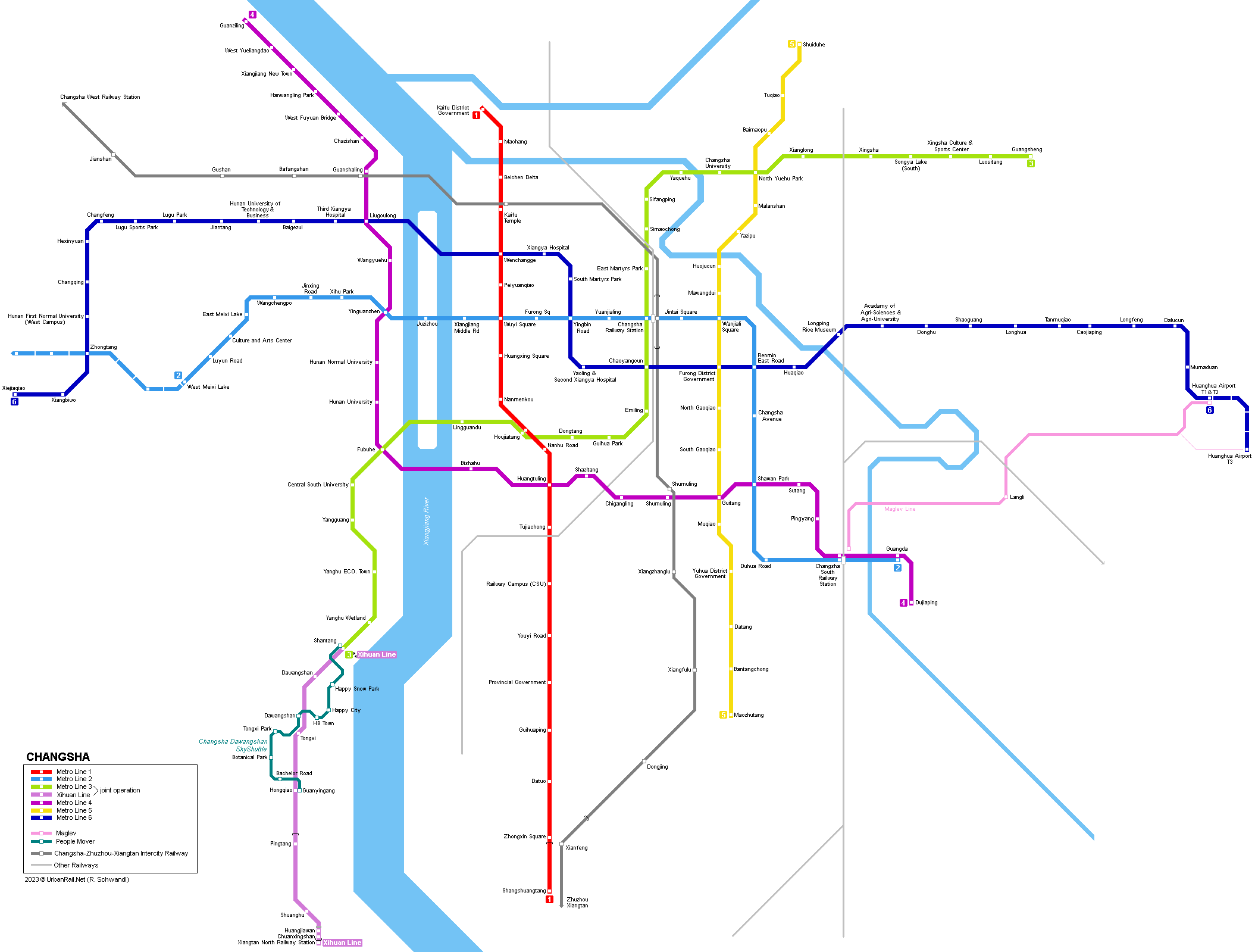
CHANGSHA
|
| Hunan . China |
|
METRO
|
|
Changsha - capital of Hunan Province; 7 million inhabitants
|
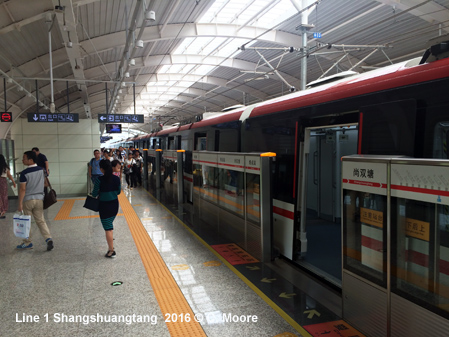
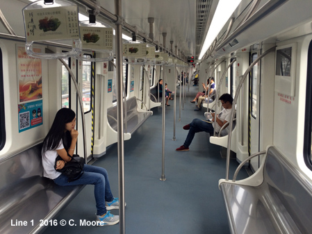
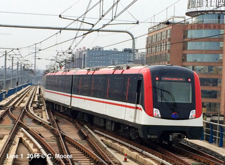
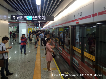
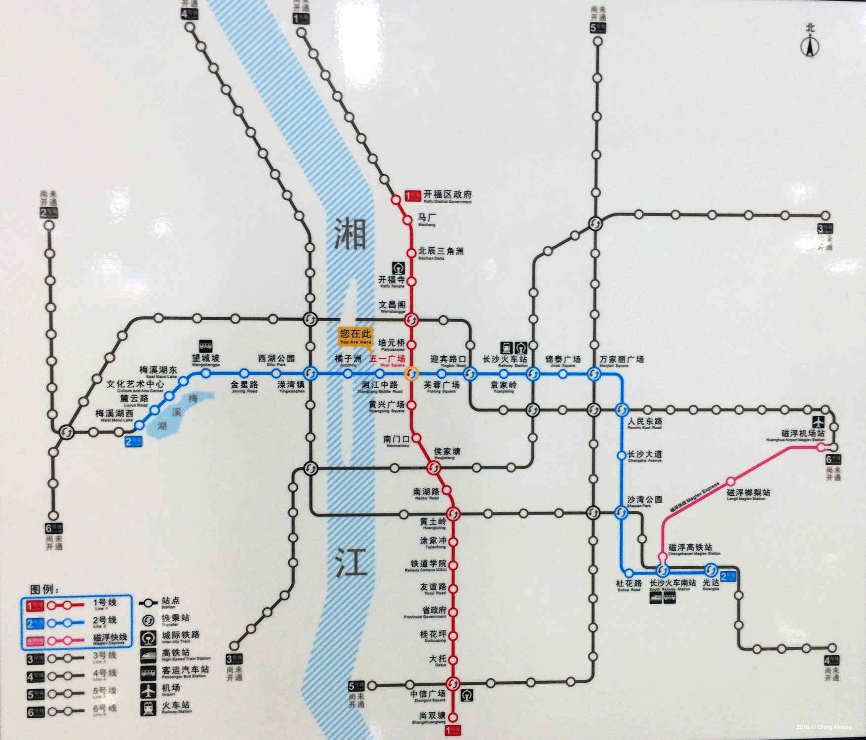
| Line 1 |
|
North-south line, 33.5 km, 25 stations 28 June 2016: Kaifu District Government - Shangshuangtang (23.6 km) 28 June 2024: Kaifu District Government - Jinpenqiu (9.9 km)
|
|
|
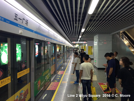
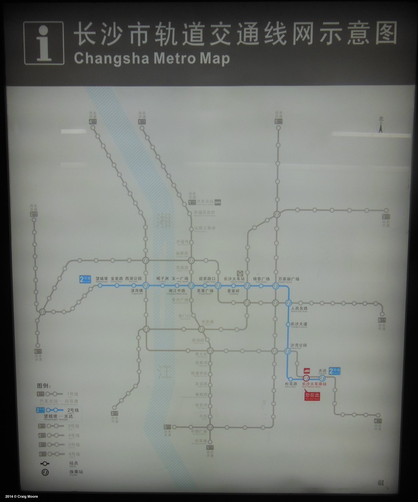
| Line 2 |
|
East-west line, 26.6 km, serving both major railway stations 29 April
2014: Wangchengpo - Guangda (22 km)
|
|
|
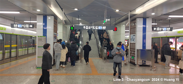
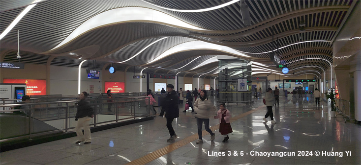
| Line 3 |
|
Southwest to northeast line, 36.4 km - at the southern end (Shantang) initially linked operationally to the Xihuan Line, 17.3 km (7.1 km lying in Xiangtan municipality) until this line became an integral part of line 3 in 2025: 28 June
2020: Shantang Guangsheng (36.4 km)
|
|
|
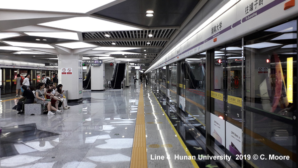
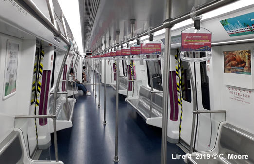
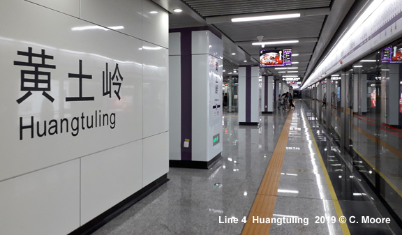
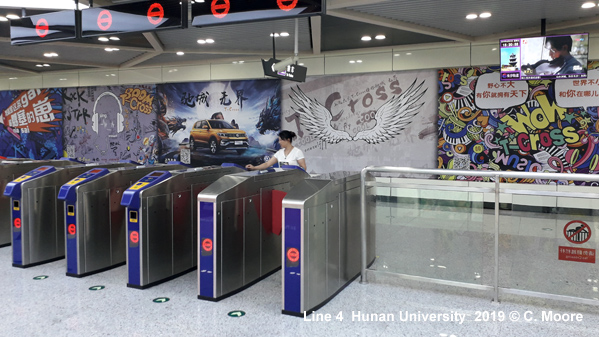
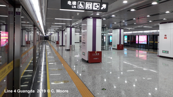
| Line 4 |
|
East-west line, 33.5 km, 25 stations 26 May 2019: Guanziling - Dujiaping (33.5 km)
|
|
|
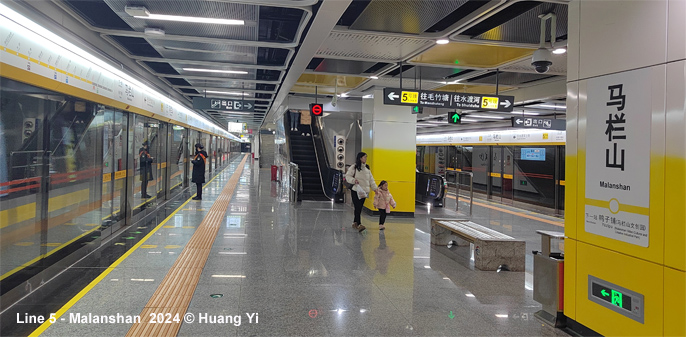
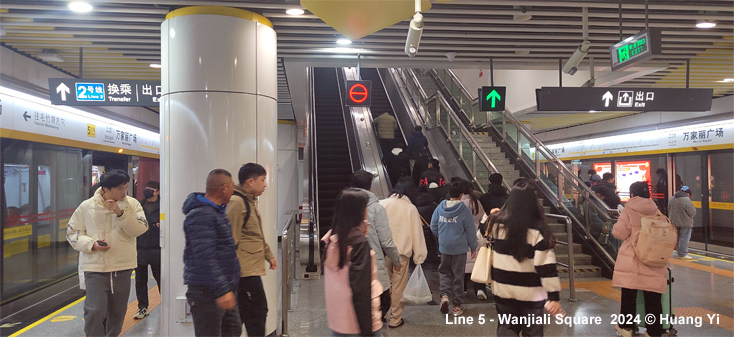
| Line 5 |
|
North-south line, 22.5 km 28 June 2020: Shuiduhe Maozhutang (22.5 km)
|
|
|
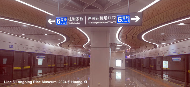
| Line 6 |
|
East-west line 28 June 2022: Xiejiaqiao Huanghua Airport T1&T2 (48.1 km)
|
|
|
|
Metro
Photos
|
|
|
|
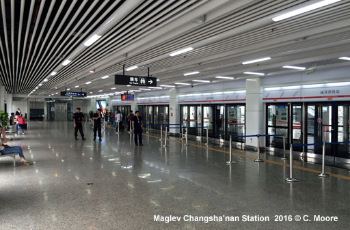
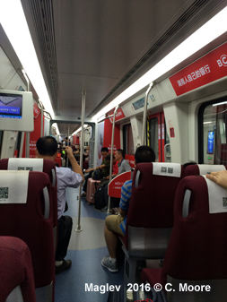
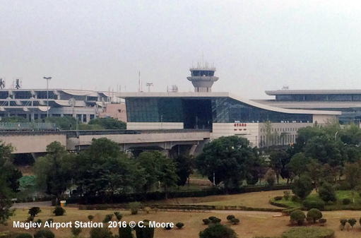
S2 - Maglev Line |
|
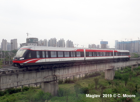
An 18.5 km maglev line started revenue service between Changsha South Railway Station and Huanghua Airport on 6 May 2016.
|
|
|
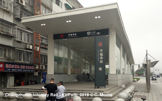
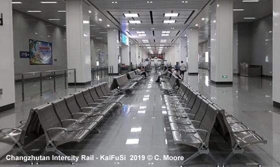
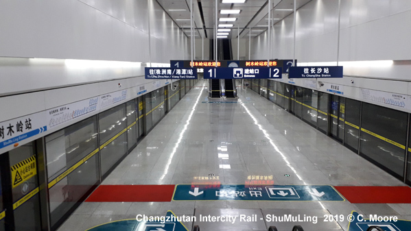
S1 - ChangshaZhuzhouXiangtan Intercity Railway (Changzhutan Intercity Railway) |
|
95.5 km regional express line operating mostly underground through Changsha
|
 |
| Changsha Dawangshan SkyShuttle |
|
Driverless elevated people mover serving several tourist attractions in the southwest of Changsha; special fares apply. 09 May 2023: Shantang Guanyingang (8.3 km)
|
|
Links
|
|
Changsha Metro Group (Official Website) Changsha Metro at Wikipedia Changsha-Zhuzhou-Xiangtan Intercity Railway at Wikipedia
|
| Report |
|
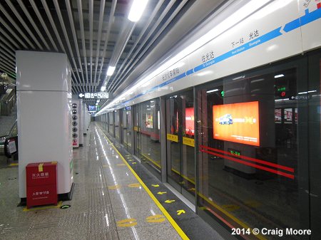
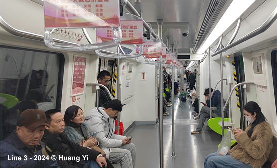
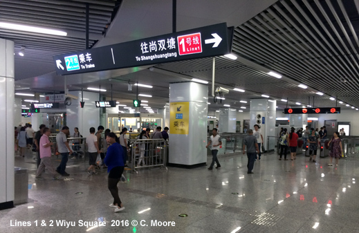
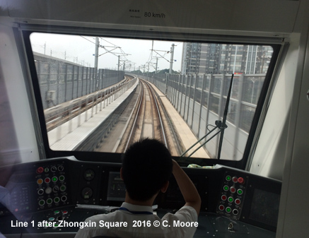
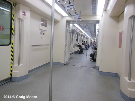
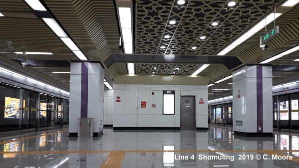
In June 2019, Craig Moore reports from Changsha: Changsha Metro had quite basic, formulaic beginnings, but with network expansion and design enhancements, it has become an impressive system, and along with additional non-metro rail provision, the Hunan capital now has an interesting urban rail footprint. Metro The rolling stock is CSR on line 1/2 and CRRC on Line 4. It is all solid stuff, with similar interiors, but Line 1 and Line 4 stock have interesting dynamic strip maps, as opposed to the flat dot progression of Line 2. Line 4 stock also has a fresher feel and little design enhancements such as colour coded handle casements at doors. The exteriors also have different colour schemes with Line 4 having bolder violet and black flashes. This is a well-used system and offers easy transfer and good coverage. Using the system is very easy with wayfinding, directional signs and audio announcements in Mandarin and English. Maps now have some style and are more conspicuous across the system. Changsha has also now produced hard copy information/maps, although these only appear to be available at certain stations. Like several other systems in China, Changsha has matured into an appealing and useful system. Maglev
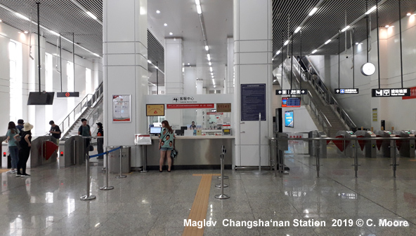
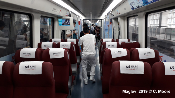
This is not a fast Maglev (58kph), and is indeed very slow on tight corners, with the journey taking 20mins. Headways are 12/15mins (0700-2100 operations) and there is quite a languid feel to operations. Doors are slow to open, alighting passenger doors open first and there are long dwell times - it certainly doesnt have the buzz of a metro. Given the long transfer time required at either terminus, the relative slowness of the service and the average headways, it is important to build in time to get to your destination. Changzhutan
Intercity Railway The underground stations have large street entrances and banks of automated ticket machines (only usable with Chinese ID card) and a small staffed ticket office. Given the complexity of CNR ticket purchase in China, this is not a turn up and go suburban rail type provision. Passengers wait in large seating areas until an announcement is made for the imminent arrival of the train. Queues form at the barriers where the national ID card is scanned and matched with the face scan on the barrier (tickets are not shown). This causes problems for passengers who do not have national ID cards (i.e all foreigners) and whilst at main stations there are staff to show passports to gain access, these suburban stations are not well staffed and so it is wise to seek staff beforehand, otherwise you cant open the barriers. The underground platforms are deep and accessed by long slow escalators. The platforms are stark white in island form and are long (8 car high speed sets are long trains!) and narrow with high ceilings. These huge spaces have a desolate feel and this is not helped by the low patronage. Full screens have a basic strip map and there are audio announcements. Interestingly, the platforms advance 2 metres beyond the platform screens and I can only assume this is to limit stress on the panels when non-stop/express trains speed pass through the stations - even with the wider space, the screens a buffeted by the air as trains pass. The ride within the main area of Changsha is quite slow and there are also long dwell times at stations, especially at Changsha Station where there is a 4min wait. This is a long way from being an intensive suburban rail service.
|
|
|
2014 © Robert Schwandl (UrbanRail.Net)