Click on map to expand!
|
[ UrbanRail.Net ] [ Europe ] [ Americas ] [ Asia ] [ Africa ] [ Oceania ] [ News ] [ Books ] [ Links ] |
|
MANILA
|
| Philippines |
Click on map
to expand!
|
System
|
|
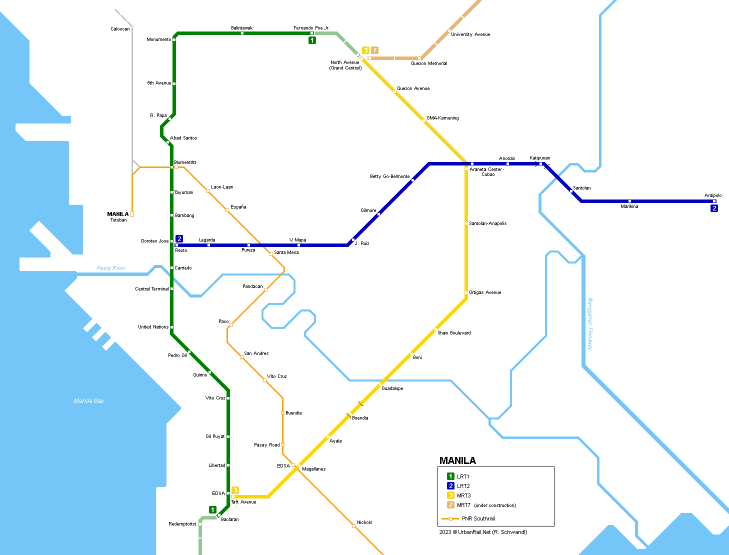
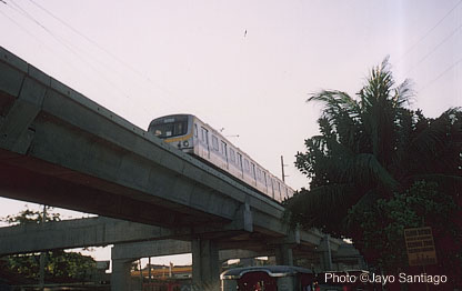
Metro-Manila, the metropolitan area of the capital of the Philippines is home to some 10 million people. The current metro system consists of three lines and is mainly elevated; despite using similar technology, two lines are referred to as LRT and one as MRT:
|
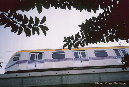
| Line 1 |
|
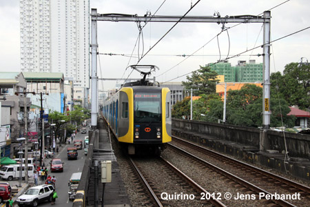
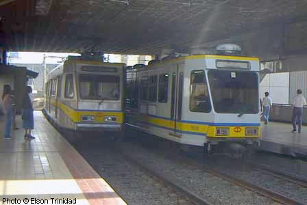
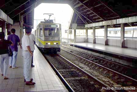
26 km, 25 stations LRT 1 is a fully elevated north-south route opened 1 Dec. 1984 (7 km) and June 1985 (8 km). It runs along Rizal and Taft Avenues (15 km, 18 stations). The capacity of the line was increased in 1998. The line runs on a precast concrete structure 7 m above the street, designed to withstand earthquakes. It has 1435 mm gauge and 750 V overhead power supply. Average station distance is 825 m, stations are only accessible via stairs, there are no elevators or escalators. Central Terminal, Monumento (original northern terminal) and Baclaran (southern terminal) function as transfer stations to buses and jeepneys. Trains operate in 2-4 car units (one unit 29.3 m long, 2.5 m wide), which have roof ventilation. 01 Dec 1984:
Baclaran - Central Terminal |
|
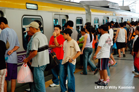
| Line 2 |
|
17.6 km, 13 stations LRT 2 (Megatren) runs from Manila in the west via Quezon City to Pasig in the east. The line is elevated except for Katipunan station, which is underground. Construction of this line started in 1998 and it runs along Recto Ave, Magsaysay Blvd and Aurora Blvd. Although called LRT, this line uses heavy rail metro vehicles. 05 April
2003: Santolan - Cubao (4.3 km) |
|
|
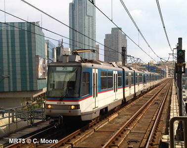
Line
3
|
|
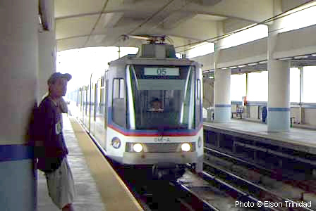
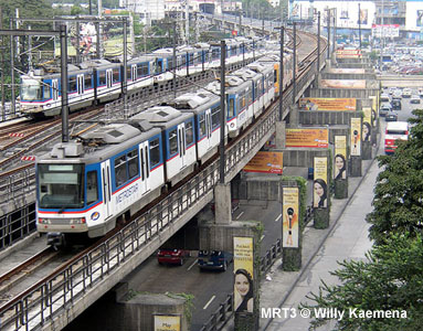
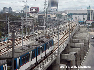
16.9 km, 13 stations MRT 3 (initially called Metrostar) runs elevated along EDSA (Epifanio de los Santos Ave.) ring road (except Buendia station which is underground). Metrostar trains are air-conditioned. 16
Dec 1999 - MRT 3 - North Avenue - Buendia |
|
|
PNR
Southrail
|
|
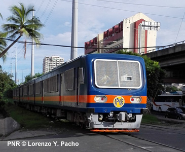
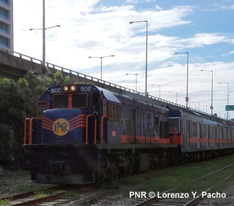
The
"Philippine National Railways" (PNR) Southrail is a commuter rail service
that starts from Tutuban station in Manila up to Calamba station located
south in Laguna province, for a total of 28 stations for 56 kilometers.
The line has narrow gauge (1,067 mm) tracks. For the commuter rail service,
the PNR Southrail uses a combination of 5-car ex-JR 203-series EMUs pulled
by GE diesel locomotives, 3-car Hyundai Rotem DMUs and 3-car ex-JR KiHa
52 DMUs.
|
|
|
Links
|
|
Light Rail Transit Authority - Official Site MRT 3 - MetroRail Yellow Line - Official Site LRT1 & LRT2 at Wikipedia MRT3 at Wikipedia 2 interesting articles in Japan Railway & Transport Review (1998) by E. Razon and G.L. Satre (History) MRT 7 Project PNR (Philippine National Railways)
|
|
|
2007 © Robert Schwandl (UrbanRail.Net)