|
[ UrbanRail.Net ] [ Europe ] [ Americas ] [ Asia ] [ Africa ] [ Oceania ] [ News ] [ Books ] [ Links ] [ Blog ] [ Shop ] |
| Hungary |
| BUDAPEST | |
|
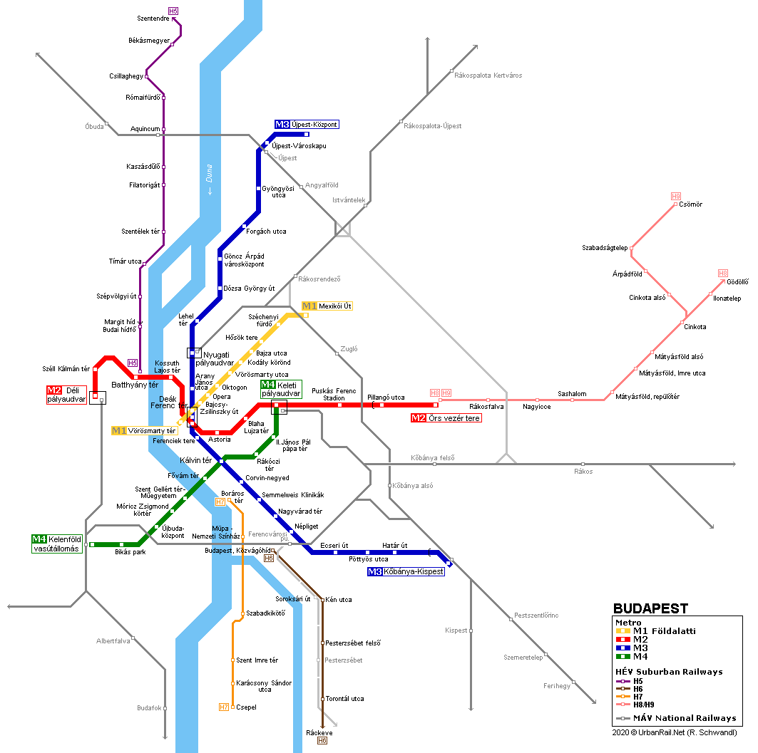
The capital of Hungary is the result of the unification in 1873 of 3 cities: Buda and Æbuda on the western side of the Danube and Pest on the eastern side. Today, Budapest has approximately 1.7 million inhabitants. With the opening of line M4 in 2014, Budapest now has a 4-line metro system, with the original three lines intersecting in the city centre at Deák Ferenc tér.
|
|
| Line M1 "Földalatti" | |
|
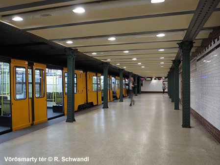
Line M1 (4.4 km) was opened in 1896 between Vörösmarty tér in the centre and Széchenyi fürd¾ as the first electric underground (Földalatti) line on the European mainland. Almost 80 years later, in 1973, the line was extended to Mexikói út. This line is different from the other two in dimensions, running directly under the street, and tunnels only 6 m wide and 2.75 m high. Therefore special trains had to be built and a fixed catenary had be installed. For the 100th Anniversary all stations were restored and once again exhibit their historic splendor. 02-05-1896
V—r—smarty tÕr (formerly Gizella tÕr) —
SzÕchenyi f■rd¾ (formerly aboveground and named ArtÕzi f■rd¾) More about line M1 |
|
|
|
|
| Line M2 | |
|
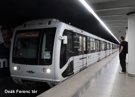
Line M2 (10 km) is an east-west line connecting two of the three major railway stations, Déli (South station) and Keleti (East station). It runs on the surface between Pillangó utca and the eastern terminus Örs vezér tere. Although construction had started already in the 1950s, this line was only opened between 1970 (Deák Ferenc tér — ørs vezÕr tere) and 1972 (DeÃk Ferenc tÕr — DÕli pu.). Between 2004 and 2007, M2 underwent total refurbishing. Since it is the busiest line in the city, stations were only closed during summer months while major work was carried out. The route was upgraded with a modern signalling system that allows one-man operation. 02-04-1970
DeÃk Ferenc tÕr —
ørs vezÕr tere More about line M2 |
|
|
|
|
| Line M3 | |
|
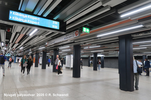
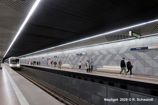
Line M3 (17.3 km) is a north-south connection on the Pest side of the city. Apart from the southern terminus Köbánya-Kispest, all stations are underground. The first part (Deák tér — Nagyvárad tér) opened in 1976, in various stages it was extended in both directions. In 1990 it reached Újpest Központ. 31-12-1976
DeÃk Ferenc tÕr —
NagyvÃrad tÕr More about line M3 |
|
|
|
|
| Line M4 | |
|
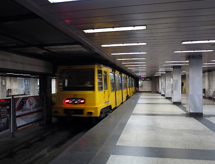
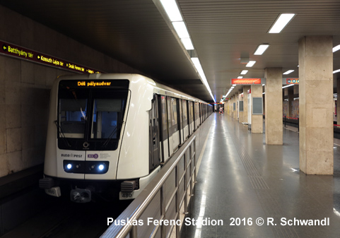
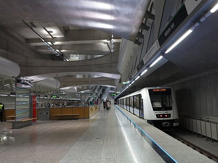
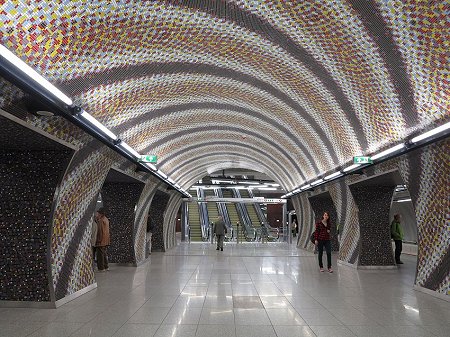
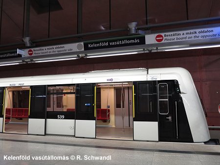
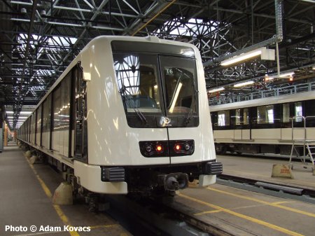
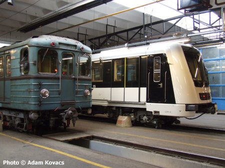
Line M4 (7.4 km) runs totally underground between Keleti and Kelenföld railway stations crossing M3 at Kálvin ter, then under the Danube river to Szt. GellÕrt ter and south-west through Buda. After long delays, the first section (Kelenföld va. — Keleti pÃlyaudvar) eventually was brought into service in spring 2014. Line M4 features driverless operation. The track area is surveilled by a infrared system, as no platform screen doors have been installed. 28 March 2014: Kelenf—ld vasºtÃllomÃs — Keleti pÃlyaudvar More about line M4 |
|
|
|
|
|
Books |
|
|
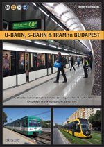
U-BAHN, S-BAHN & TRAM IN BUDAPEST (Urban Rail in the Hungarian Capital) The
Hungarian capital offers urban rail enthusiasts a remarkable variety of
transport modes, ranging from the classic tramway to four different metro
lines (including the oldest underground railway on the European continent
as well as a driverless line) and several local railways extending into
the surrounding area, up to regional trains with modern rolling stock.
In addition, there is a funicular, a cog railway, and the Budapest Children's
Railway. Trolleybus fans will also find plenty to enjoy in Budapest. 02/2026, Text deutsch/English, ISBN 978 3 936573 83 1, EUR 19.50 - For more info & sample pages click here! |
|
|
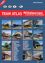
Robert Schwandl's TRAM ATLAS MITTELEUROPA | CENTRAL EUROPE (incl. Poland) This
illustrated atlas includes every tramway system in East-Central Europe,
from Poland via Czechia and Slovakia to Hungary. The atlas also covers
the three metro systems in the region, as well as trolleybuses in cities
with tramways. 10/2024, Text deutsch/English, ISBN 978 3 936573 76 3, EUR 24.50 - For more info & sample pages click here! |
|
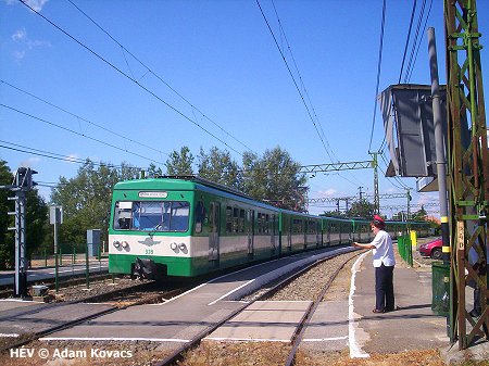
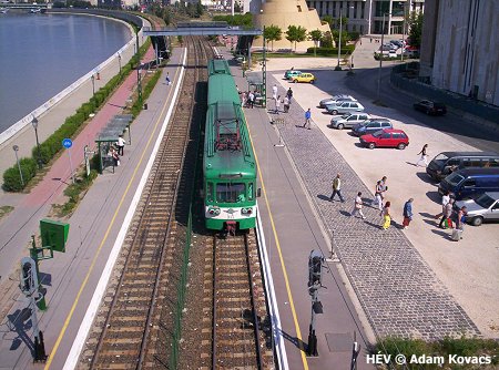
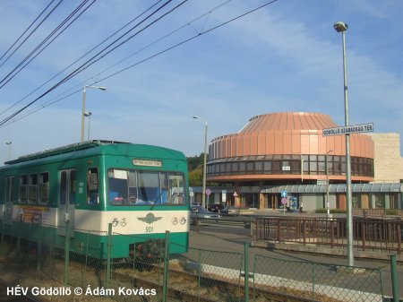
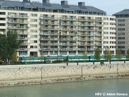
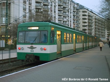
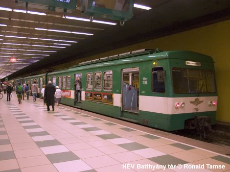
| HÉV (Suburban Rail) | |
|
Out of four HÉV-lines, only two are directly connected to the metro
system.
The line to Szentendre (H5) in the north leaves from Batthyány tér (M2) and runs underground as far as Margit híd. During day time trains run every 10 minutes with every second train only as far as BÕkÃsmegyer (city limit). This Stadtbahn type has level crossings all along the route. The eastern line to Csömör (H9) and Gödöllö (H8) leaves from M2's eastern terminus at Örs vezér tere with trains every 20 minutes. The two southern lines to Csepel (H7) and Ráckeve (H6) can only be reached by bus or tram. |
|
|
|
|
| Metro Museum | |
|
At Deák Ferenc tér, in the former Földalatti station, there is a Metro Museum showing the original trains of today's M1 and illustrating the history of the Budapest Metro.
|
|
| Links | |
|
BKK Official Site - Budapest Transport Authority - Public Transport in Budapest BKV Official Site - Metro & Tram Operator Line
4 project includes detailed information on stations and construction
METROS by êdÃm KovÃcs Budapest Metro at Wikipedia Track map 2002 (by Stefan Baumgartner) Földalatti > about the former surface section of the present M1 Földalatti > about the old rolling stock on the present M1 BLOG: Your webmaster's impressions on the for Budapest metro & tram system (April 2014) |
|
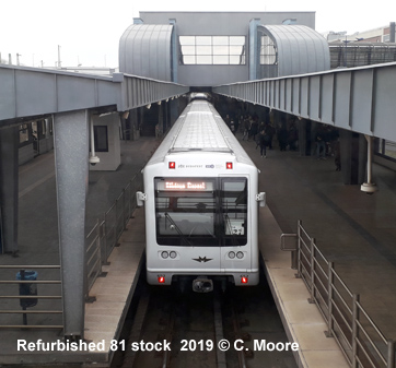
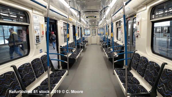
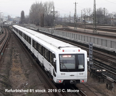
| Trains | |
|
|
|
Basic Hungarian for metro users:
földalatti - underground, felé - direction, tér - square, híd - bridge, pályaudvar - rail station, kijárat - exit
Former names:
Lehel tÕr was èlmunkÃs
tÕr until 1989
Ferenciek tere was FelszabadulÃs tÕr until 1989
PuskÃs Ferenc Stadion was NÕpstadion until 2002 and Stadionok until 2011
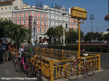
Oktogon was November 7. tÕr until 1989
Nyugati pÃlyaudvar was Marx tÕr until 1989
SzÕll KÃlmÃn tÕr was Moszkva tÕr until 2011
RÃkµczi hÚd was LÃgymÃnyosi hÚd until 2011
Corvin-negyed was Ferenc k—rºt until 2011
G—ncz
êrpÃd vÃrosk—zpont was êrpÃd
hÚd until 2019
Semmelweis Klinikák was just Klinikák until 2019
2011
© UrbanRail.Net by Robert
Schwandl.